Our work
There are many problems to be solved for a more sustainable future. This is why we also create multiple tools to help us get closer to our vision of a better planet for all. Read more about them below!
-
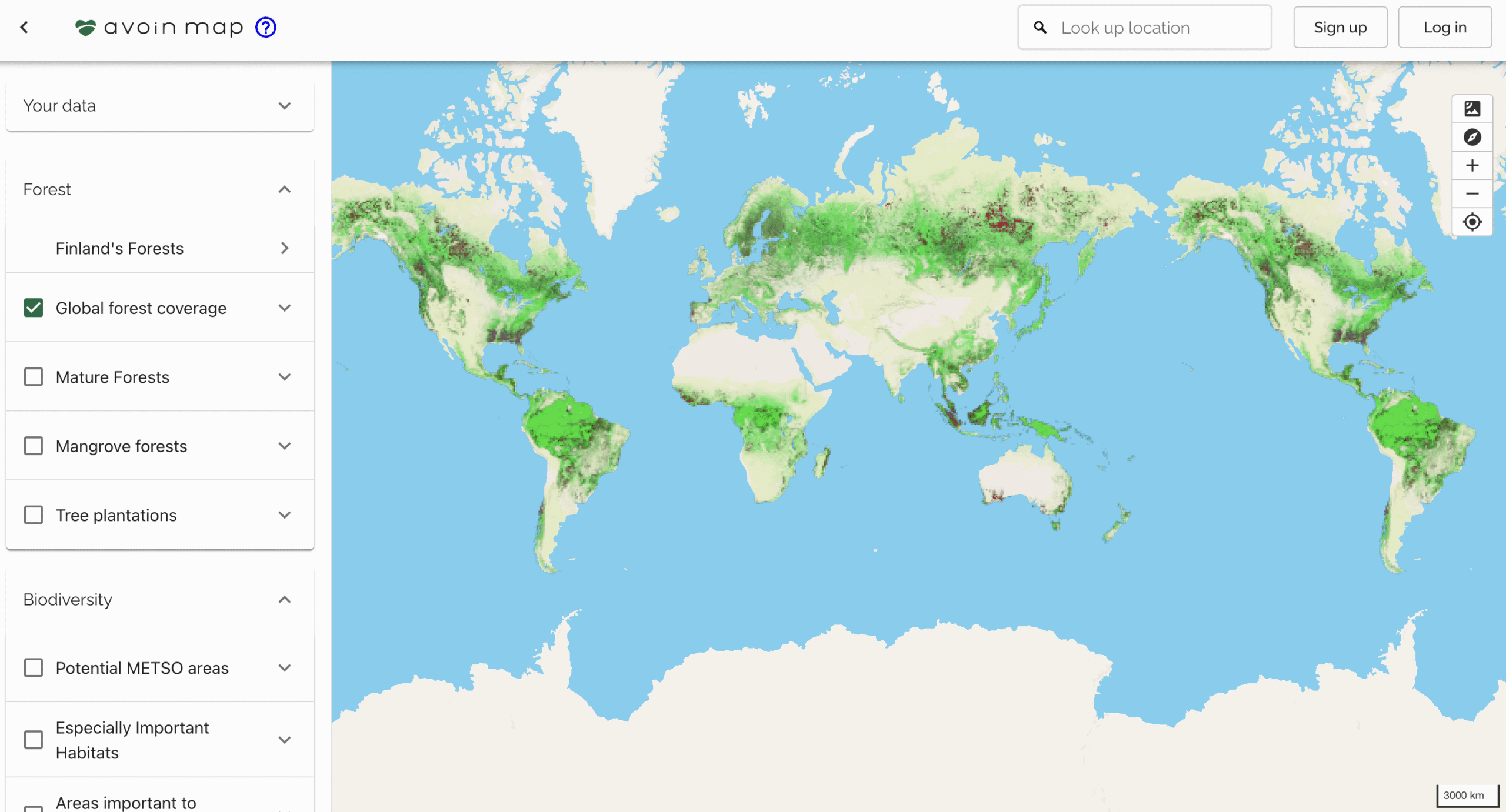
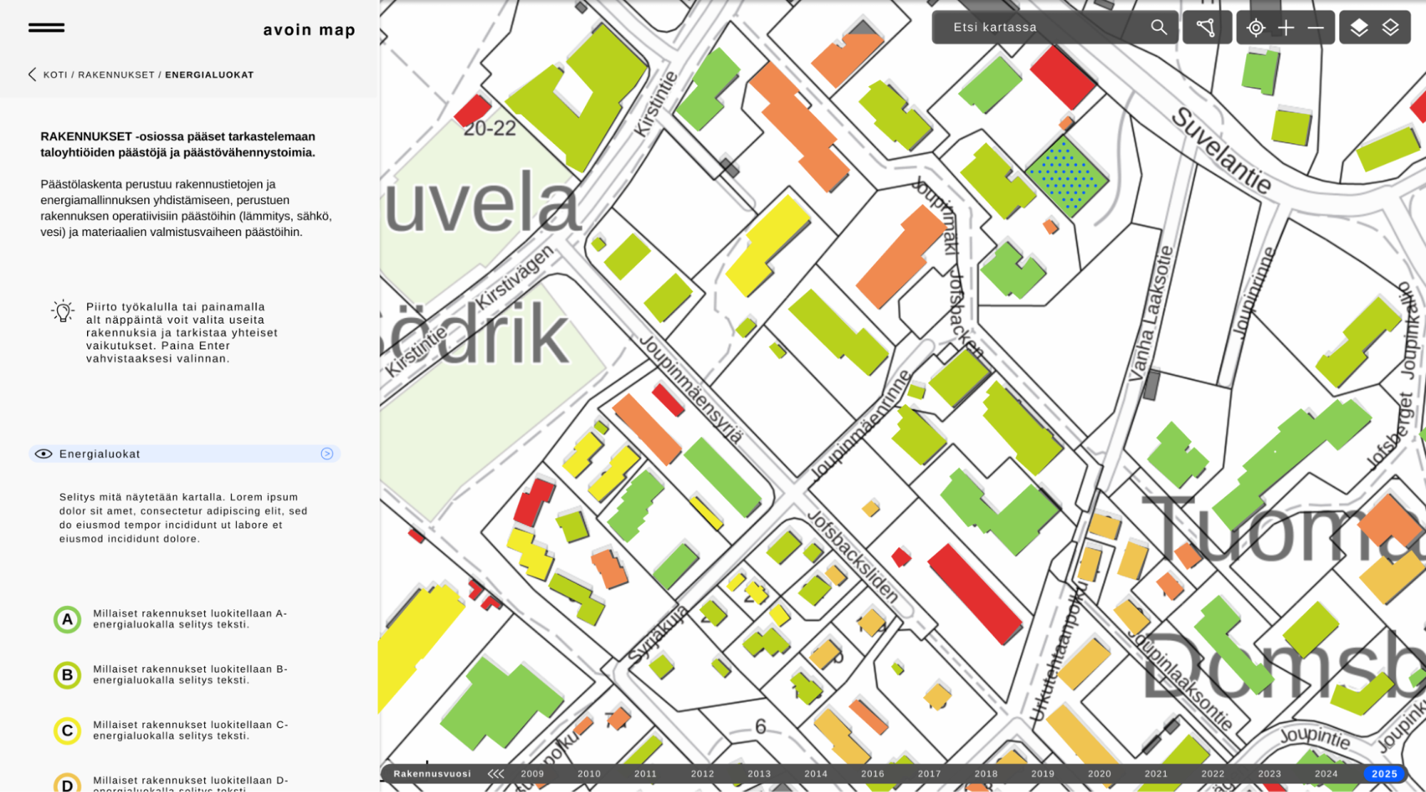
Avoin Map
Last updated: 1.10.2025 Avoin Map supports the green transition in agriculture, forestry, and zoning. It combines open-source environmental data with digital management tools for sustainable development. Avoin Map presents environmental data in a simple and approachable way. Map applets help farmers, forest owners, and building owners make a green transition on their properties by supporting planning and monitoring based on transparent scientific models. In the future, Avoin will continue the development of Avoin Map with feasibility studies and demo projects in Finland and around the world in collaboration with producers, living labs, companies, policymakers, and authorities. Status and newsPublished, constantly…
-

Avoin Map – Smart Forest Decisions
Last updated: 23.8.2025 This project expanded Avoin Map´s usability by adding the first machine learning algorithm on forests. Avoin´s first machine learning model predicts forest biomass and carbon using ESA Copernicus satellite data. The web map service turns the Finnish Forest Centre’s open forest data into actionable insights based on modelling powered by the Forest Service Arvometsä. The resulting free web service and a biomass algorithm acts as a digital decision support for forest owners and policymakers. Avoin Map´s forestry tool supports forest owners and policymakers with insights about the Finnish forests’ current carbon stock and future development scenarios under…
-
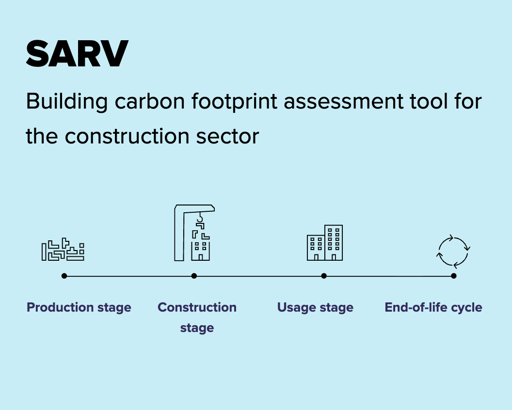
SARV
Last updated: 2.10.2025 SARV is a Carbon Footprint quantification tool for architects & engineers. This open-source emission calculator supports sustainable construction. SARV was created for TalTech and is based on an open emission factor database. The calculator helps architects calculate the emissions of building materials and is based on the principles of transparency in its methodology, factors, and accuracy level. It may be expanded to include energy emissions calculations. Status and newsPublished, in active use in Estonia.
-

Digioptimi
Last updated: 7.2.2026 This project will develop an open-access and free online calculator that estimates the energy consumption and emissions of software, artificial intelligence, and digital devices. The calculations are based on measurements, open emission databases, and region-specific emission factors. The tool provides reliable recommendations for optimising energy use and reducing emissions. Information and communication technology accounts for 3–4% of global emissions, and the sector’s energy consumption is expected to increase significantly, particularly due to the growing demand for data centres. This poses challenges for Finland’s energy self-sufficiency and climate targets. The solution supports organisations in improving energy efficiency, achieving…
-
GHG.EE – Transparent Emission Reporting
Last updated: 23.8.2025 In this project, TalTech’s initiative resulted in a free, open-source greenhouse gas (GHG) quantification tools tailored for organisational use in the business and building sectors. The tools built by Avoin in collaboration with TalTech apply a hybrid method combining the GHG Protocol and environmentally extended input-output (EEIO) models, ensuring comprehensive and accurate coverage of emissions. Built in English and Estonian and hosted by TalTech, the tools integrate local emission factors, open APIs, and accounting data, enabling organisations to evaluate climate impacts and support national climate strategies. The project also laid the foundation for a long-term partnership with…
-
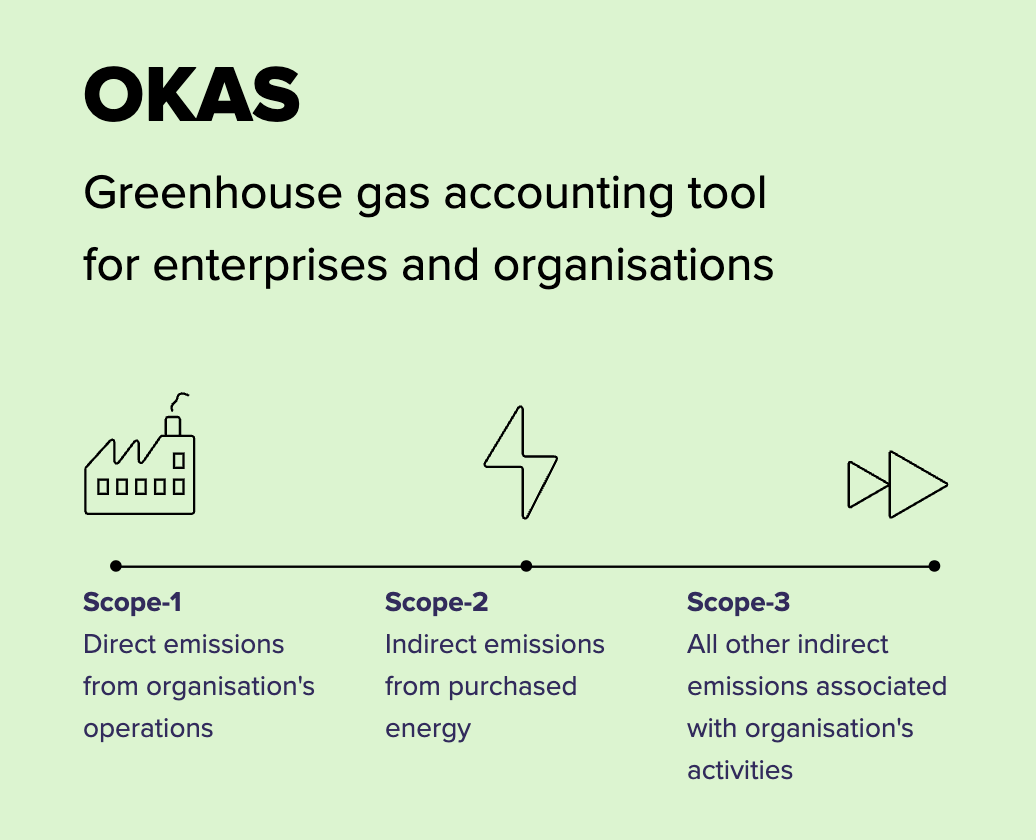
OKAS
Last updated: 2.10.2025 OKASC is a GHG Accounting tool for enterprises and organisations. This free emissions calculator created for TalTech build upon an open emission factor database designed for research institutions and information technology companies. The calculator allows companies to calculate their emissions and is based on the principles of transparency in its methodology, factors, and accuracy level. The tool can be automated to calculate emissions directly from the chart of accounts and may also be expanded to other sectors. Status and newsPublished, in active use in Estonia.
-
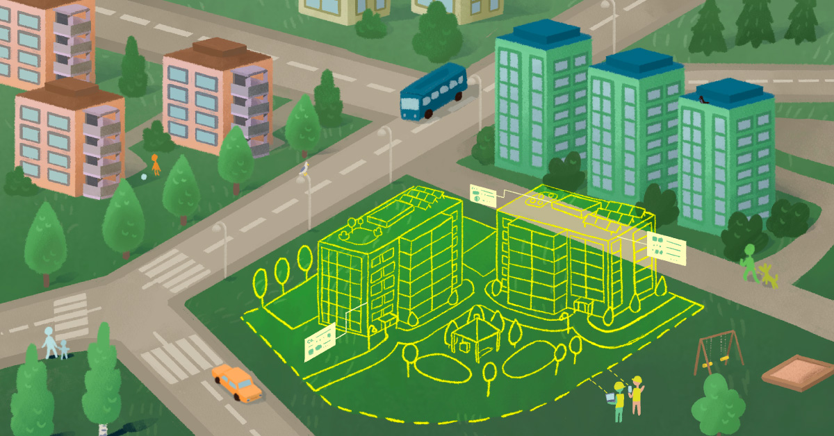
Carbon Map – Zoning Climate Impacts with Ease
Last updated: 7.2.2026 This collaborative project resulted in a digital map service for sustainable zoning. A collaborative open-source project by the Finnish Environment Institute, Natural Resources Institute Finland, and Avoin. In this project, we created an open-source web map application for zoning officers. With the app, they can evaluate the soil and vegetation climate impacts of zoning plans and create more sustainable plans. Status and newsThe service is maintained by and further developed by Avoin. New energy grid features and map layers are expected in 2026 in connection with the Finnish Environment Institute’s REPowerCEST project. Links https://hiilikartta.avoin.orghttps://www.syke.fi/fi/projektit/kaavoittajan-karttatyokalu-hiilikartta Billboard Illustration: Linda Mandell, Avoin
-
Zoning map
Last updated 7.2.2026 This digital map applet supports sustainable zoning. Zoning Map is a digital map applet that helps zoning officers evaluate the soil and vegetation climate impact of zoning plans and create more sustainable plans. The Finnish prototype was co-created with the Finnish Environment Institute and the Finnish Natural Resources Institute. The service is enhanced with biodiversity and socioeconomic metrics and scaled internationally using open-source Avoin Map technology. Status and news Published, 100+ monthly unique zoning plans evaluated. Beta release expected in 2026. Illustration: Tuula Cox, Avoin
-
Space4Cities – Zoning Impact Measurements with Space Data
Last updated: 23.8.2025 This project develops a digital platform for assessing zoning impacts using Earth observation data. The result zoning impact assessment tool is scalable and web-based, and integrates EO data with local planning, empowering municipalities to make climate-smart urban land-use decisions. During the project, Avoin Map develops the ZIM – Zoning Impact Mapper as an open-source planning platform for European cities. ZIM combines Copernicus Sentinel satellite data, AI-powered land cover models, and local zoning inputs to assess long-term carbon, biodiversity, and social impacts of land-use changes. The service enables transparent, scenario-based planning and helps cities align with EU climate…
-
Lifestyle Calculators
Last updated: 4.10.2025 These emission calculators promote sustainable consumption. In the EU project “1.5 Lifestyles,” free household emissions calculators were developed for Hungary and Latvia in collaboration with the tool owners GreenDependent Institute (HU), Zala Brīvība (LV), and methodological partner D-mat (FI). Tools are based on customizable emission factor databases. The calculators help households calculate their consumption emissions based on questions and emission factors that can be modified through an admin feature. The admins can also modify the visual presentation of the results. Contact the tool owners for more. StagePublished, in active use in Latvia and Hungary
-
Lifestyle Calculators – Personal Carbon Web Tool Development
Last updated: 23.8.2025 GreenDependent Institute and Zala Brīvība initiated the first citizen carbon calculators for Hungary and Latvia. Avoin Ry developed user-friendly carbon footprint calculators with admin interfaces in collaboration with GreenDependent Institute (HU), Zala Brīvība (LV), and D-mat (FI) for the EU 1.5° Lifestyles project. The calculators support sustainable lifestyle decisions through regionalised, accessible, and interactive online tools, enabling users to assess their emissions and helping admin organisations keep the tools up-to-date and promote climate-friendly behaviour. Status and news The service is in active use in Hungary and Latvia. Illustration: Lara Jasim, Avoin
-
Energy Map
Last updated: 4.10.2025 This upcoming mapping tool helps improve sustainable energy consumption in buildings. Supported by the ERDF, and previously the City of Helsinki, and the Ministry of the Environment, the Energy Map is an open-source mapping tool for assessing building emissions and recommending energy renovations. It presents emission estimates and energy renovation recommendations for buildings, along with lifecycle assessments, based on open spatial data. It also enables data refinement and collaboration between housing companies. The service is still in the development phase. StageIn development, a beta release is expected in 2025. Illustration: Lara Jasim, Avoin
-
Energy Map – developing an open web tool for energy renovation
Last updated: 23.8.2025 This project results in a free map platform for guiding building energy decisions. Avoin develops the Energy Map with the engagement of the Uusimaa region’s stakeholders. This digital tool integrates open building data with more exact data filled in by users. It enables visual and scenario-based planning and comparison of sustainable energy solutions. The service helps building owners and energy communities improve energy efficiency, reduce emissions, and plan for energy self-sufficiency using location-specific data. The project is 75% funded by the European union. The authority administering the funding is The Centre for Economic Development, Transport and the…
-
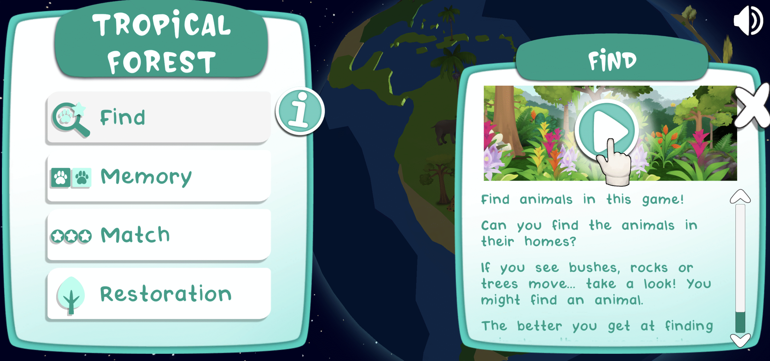
Forest Kids
Last updated: 4.10.2025 This online game teaches children about forest biodiversity around the world. Forest Kids is a mobile and desktop game published by the Food and Agriculture Organization of the United Nations (FAO) with the support of the European Space Agency, and with Avoin’s technical assistance. The game features tropical, boreal, temperate, and arid forest biomes, including information about their flora and fauna, ecosystem services, restoration, wood and non-wood products, and much more. StagePublished, 15,000+ unique players
-
Forest Kids – Producing a Global Biodiversity Game
Last updated: 23.8.2025 FAO’s initiative brings together education, ecology, and storytelling through a multilingual, web and mobile game for children. Forest Kids introduces biodiversity and restoration concepts in an accessible way, with a strong visual identity and modules co-developed with experts and international partners. It is featured by the FAO and ESA as an example of engaging environmental education. The goal of the project is to produce a cross-platform digital game (web, iOS, Android) followed by new “Restoration Module” launching at SER2025, and supported by animated biodiversity content and a FRA-BTR synergy explainer video. Status and news There´s a remarkable…
-

Avoin E-Learning
Last updated: 4.10.2025 Avoin’s first e-learning course features ethical foundation models for sustainable development and inclusion. The SDG Challenge educates and experiments with AI solutions aligned with the UN Sustainable Development Goals. It promotes responsible development of geospatial, climate, education, and medical AI by integrating ethical principles into next-generation models. StageIn development, release is expected in 2025.
-
SDG Challenge – Ethical AI Futures
Last updated: 23.8.2025 In this project, Avoin and GreenInvent Education in collaboration with researchers educate on the use of ethical AI models to address global challenges defined by the UN Sustainable Development Goals (SDGs). The project result is an e-learning course and data challenge that supports the ethical and sustainable development of foundation models for SDG-aligned AI innovation. Status and news The EIT Deep Tech Talent, an Initiative of the European Institute of Innovation and Technology (EIT), Europe’s largest innovation ecosystem, has reached a major milestone: one million individuals trained in deep tech in Europe. The EIT Deep Tech Talent…
-
Agricultural Map
Last updated: 4.10.2025 This open-source mapping tool assesses the environmental impact of a farm. Supported by the Ministry of Agriculture and Forestry and Ålandsbanken, the Agricultural Map is an open-source mapping tool for assessing the profitability, carbon and water footprints, biodiversity, and water impacts of a farm and region. It presents agricultural modelling based on open statistical and spatial data, as well as more detailed information provided by the landowners. The service is still in the development phase. StageIn development, a beta release is expected in 2026. Illustration: Tuula Cox, Avoin
-
ReLive – Open Circular Farming Models
Last updated: 23.8.2025 This international research project focused on circular mixed farming modelling frameworks. The goal of the project was to produce open-source environmental and economic assessment frameworks for field, farm, and product levels to build digital decision support for farmers and policymakers. Avoin with partners from Ireland, Germany, France, Netherlands, Poland, Estonia, New Zealand, and Chile did research on circular mixed farming and its impact on GHG emissions. Avoin´s work included digitalising an open-source farm sustainability assessment methodology, adapting the default values and emission factors to Finland, contributing to socioeconomic survey design, as well as establishing an Open Farm…
-
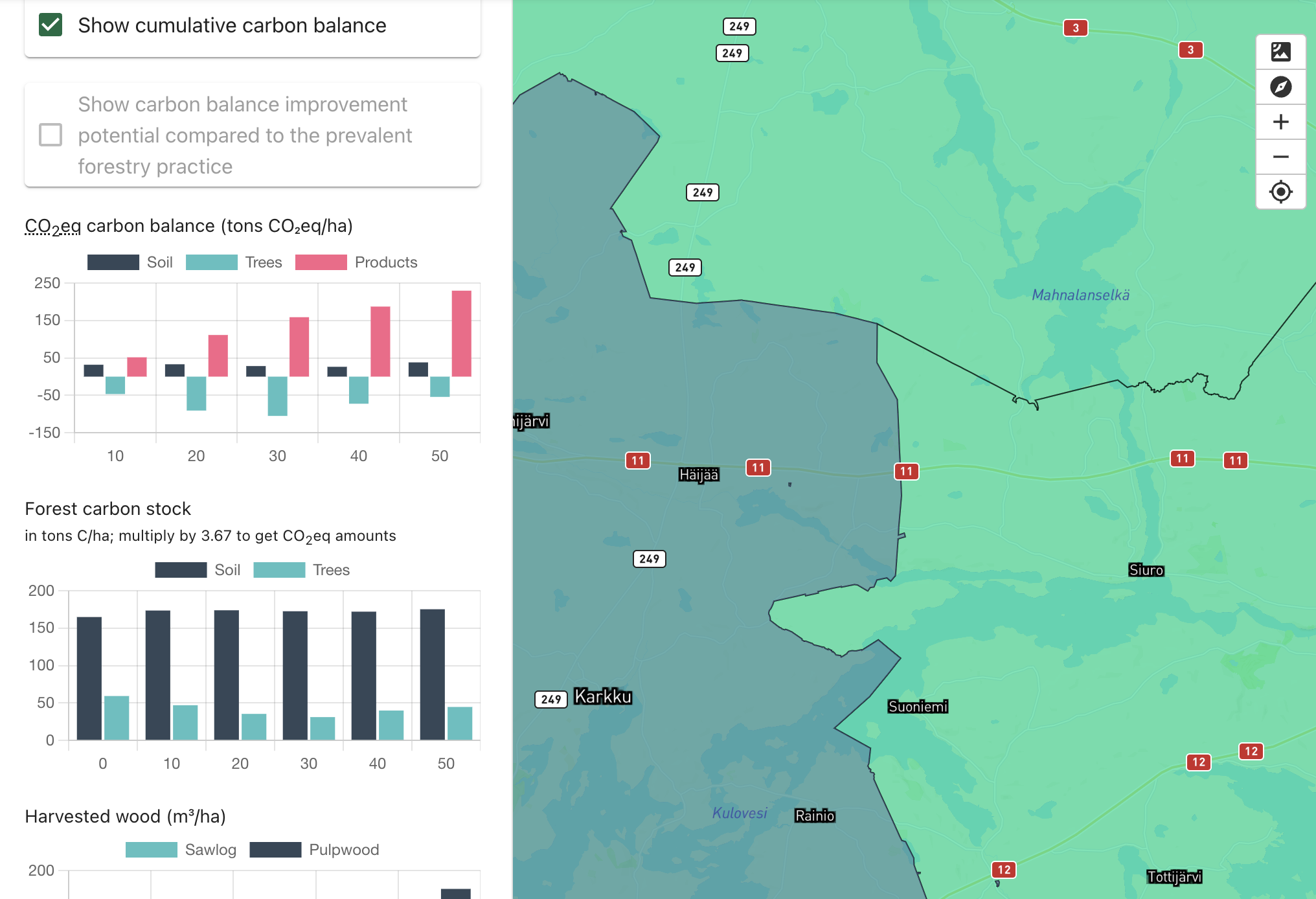
Forest Map
Last updated: 4.10.2025 This open-source mapping tool assesses the environmental impact of a forest. Supported by the European Space Agency, and Business Finland the Forest Map is an open-source mapping tool for assessing the carbon balance, biodiversity, and water impact of forests over their lifecycle. It presents forest modelling based on open spatial data from the Finnish Forest Centre and enables data refinement and forest planning. The service is still in the development phase. StagePublished, constantly developed further
-
Open Tool and Data – Foundation for the Cleaner Baltic Sea
Last updated: 23.8.2025 This project started the development of Avoin Map, a sustainable mapping tool. The first version of Avoin Map provided an evaluation of the field environmental status in Finland in 2019. A follow-up project developed a tailor-made user interface design for farmers to evaluate carbon and water emissions and emission reduction potentials of a farm and its plant and animal products. The project resulted in Avoin Map web service infrastructure, piloting the free Solagro -Carbon Calculator, the Finnish Environment Institute’s Vemala -water runoff models, and Natural Resources Institute Finland’s carbon calculation methods for farming on peatland fields. Status…
-
Silva Forest Calculator
Last updated: 4.10.2025 This calculator provides information for sustainable forest management. The Forest Calculator is published by Silva, an association for continuous cover forestry with Avoin’s technical assistance. It provides information on the effects of forest management methods on water bodies, profitability of forestry, and climate. Biodiversity may be added. StagePublished, in active use in Finland
-
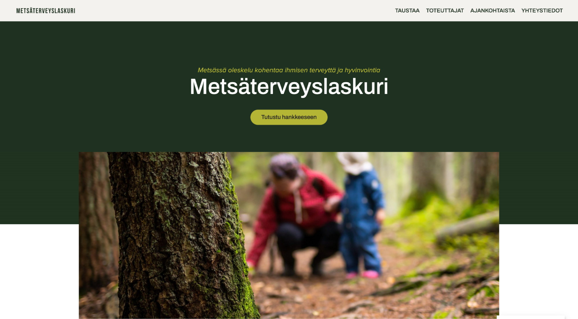
Forest Health Calculator – Developing a wellbeing accounting tool
Last updated: 23.8.2025 This is a joint project for developing web dashboards for the health benefits of forest visits. Avoin and partners develop a national online tool to estimate the public health impacts of forest exposure. The tool is based on open data from the Finnish Institute for Health and Welfare (THL), Finnish Forest Center, and open models by the Sosped Center, University of Jyväskylä, University of Helsinki, and Natural Resources Institute Finland, and delivered as a visual Power BI web dashboard by Avoin and Greenstep. Status and news Beta release expected in 2025. Illustration: The Finnish Association for Nature…
-
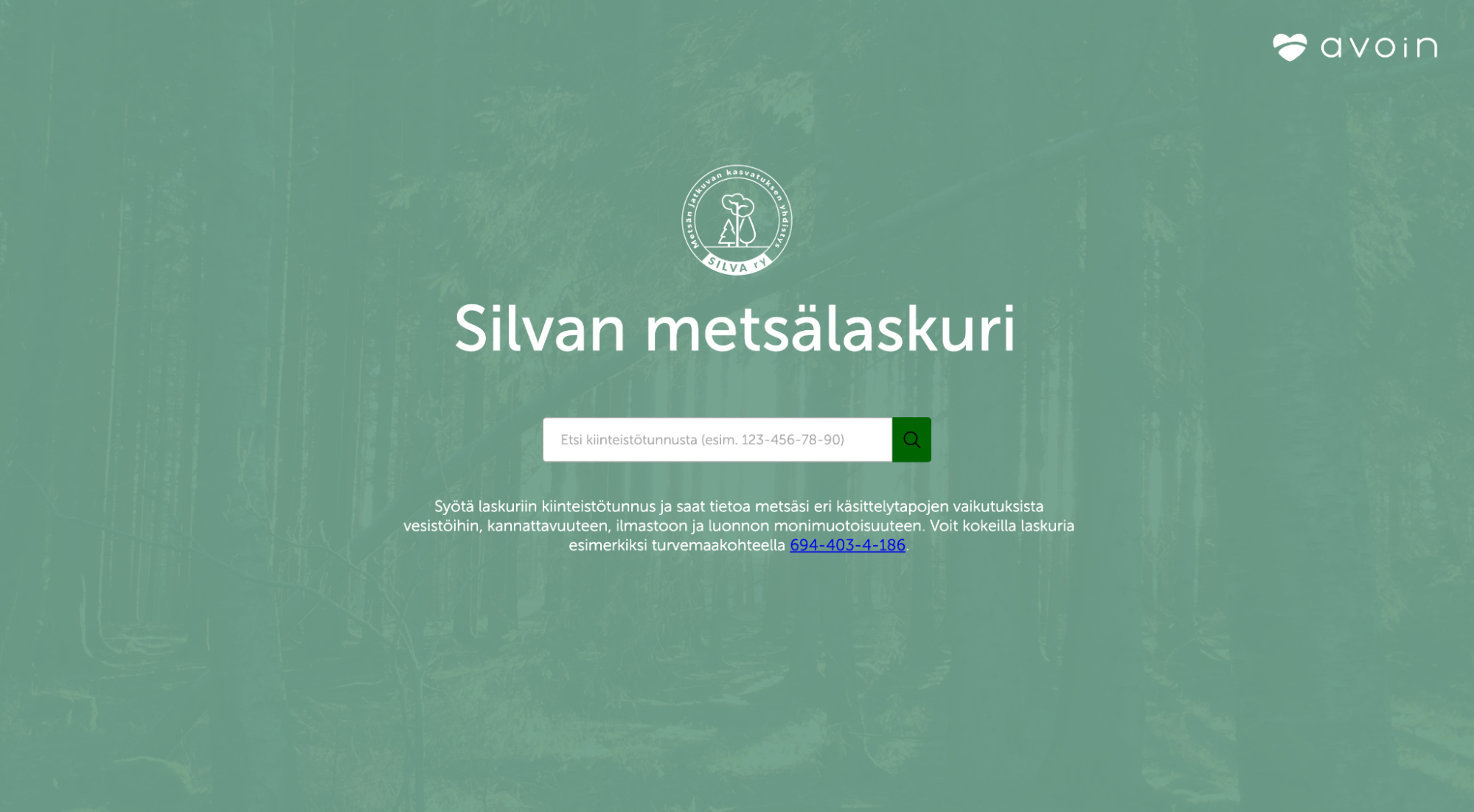
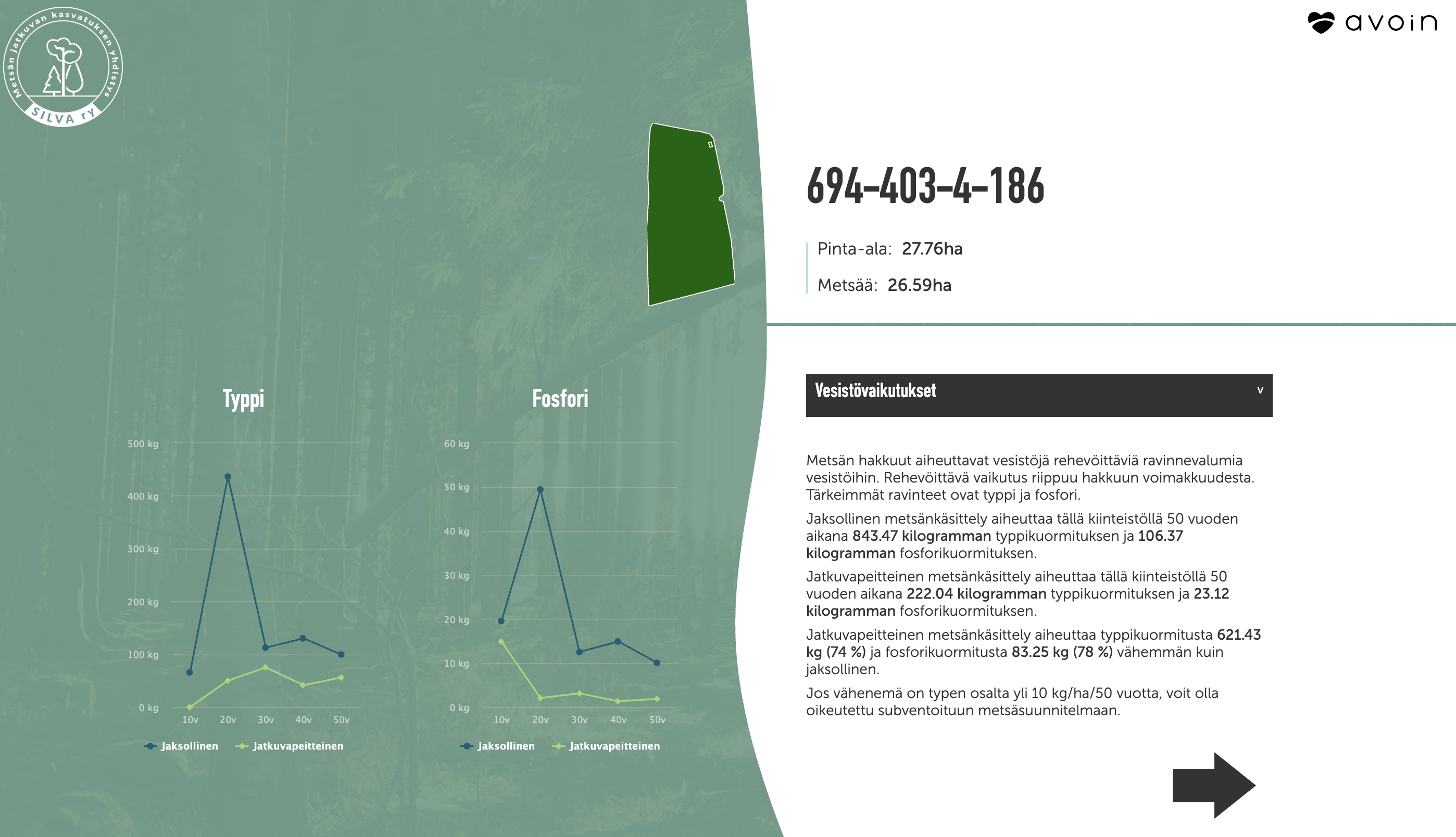
Forest Calculator – Forestry Impact Evaluator
Last updated: 23.8.2025 The project initiated a web tool helping forest owners reduce water pollution, increase the carbon sink, and improve forest value. This joint project between The Association for Continuous Cover Forestry in Finland, Natural Resources Institute Finland, Forest Service Arvometsä, and outsourced partner Avoin developed a free online forest calculator to help landowners compare the water quality, carbon impact, and profitability of different forestry methods. Using open forest data, it provides site-specific insights to support sustainable forest management, particularly on peatlands where clear-cutting and ditching cause significant nutrient leakage into the Baltic Sea. Status and news The service…
-
DIGI-GROW – Digital Twin for Agrivoltaics
Last updated: 23.8.2025 This project is a data-driven European initiative to optimise agrivoltaic systems for resilient and profitable agriculture. The goal of the project is to build an open, farmer-friendly web platform for simulating, planning, and managing agrivoltaic production. For this project, Avoin partners with experts from Germany, Spain, and Turkiye to develop an integrated simulation and decision-support web platform to optimise the dual use of land for crop production and solar energy. The tool combines meteorological, energy, and agronomic data to support farmers, advisors, and energy communities in real-time planning, monitoring, and resource management. Demonstration sites in Spain and…
-
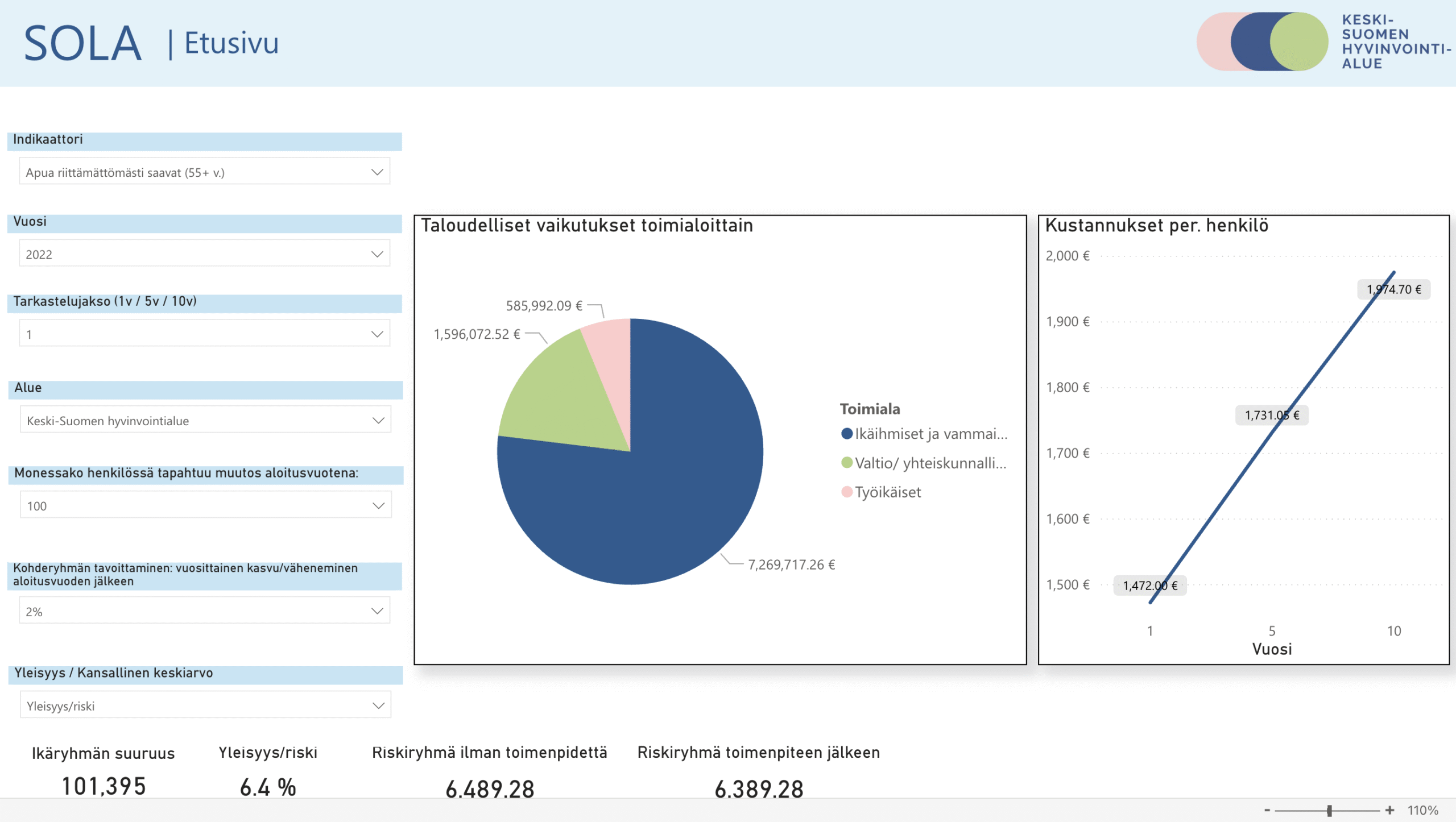
SOLA
Last updated: 4.10.2025 Sola is a digital tool that makes social impact budgeting visible, strategic, and accessible. SOLA enables municipalities and wellbeing counties to assess long-term social and economic impacts of policy decisions. The open-source tool supports prioritisation of actions that improve wellbeing and reduce costs through data-driven visualisation and planning. StagePublished, in active use in the Finnish wellbeing counties
-
SOLA – developing a social impact budgeting tool
Last updated: 28.10.2025 Wellbeing Services County of Central Finland initiated a free web tool for evaluating well-being investment effectiveness.Avoin with Wellbeing Services County of Central Finland, SosPed Center, and Greenstep developed an impact assessment matrix that supports decision-making in municipalities and wellbeing services counties. It combines social quality theory with wellbeing and cost indicators, enabling strategic planning across 1-, 5-, and 10-year timelines. With support from national stakeholders, the open Microsoft Power BI tool helps prioritise actions that improve wellbeing and yield cost savings over time. The project will result in SOLA 2.0 – a matrix-based web decision-support tool for…
-

Avoin Care
Last updated: 4.10.2025 A free citizen diagnostic service currently in the planning stage. The first co-design was made in collaboration with European patient organizations. The service aims to help people concerned about their health by familiarizing them with disease symptoms, ensuring that nothing critical is overlooked during diagnosis. The service will also help diagnosed patients understand the stages of their illness, related treatment options, and potential side effects. Naturally, the service will require precise maintenance and must be kept up to date for accountability. Stage Concept, a development project will be planned with health sector stakeholders. Illustration: Tuula Cox, Avoin
-

HOLOSEU – EU-Wide Farm Assessment Tool
Last updated: 23.8.2025 This collaborative European project develops a next-generation decision-support platform to assess agricultural practices on farm and regional levels. The goal of the project is to build and open-source digital software prototype (HOLOSEU v3.0) for quantifying climate, economic, and biodiversity impacts in agriculture across the project countries, tailored to national conditions and farmer usability. Avoin with partners from Ireland, Germany, Turkiye, Romania, Poland, and Estonia upgrade the HOLOSEU model with enhanced geospatial, climate, and economic data modules, enabling precise climate-smart scenario simulations. Avoin’s role focused on geospatial PostGIS database creation, API connections for Copernicus data, user-centred interface design,…
-
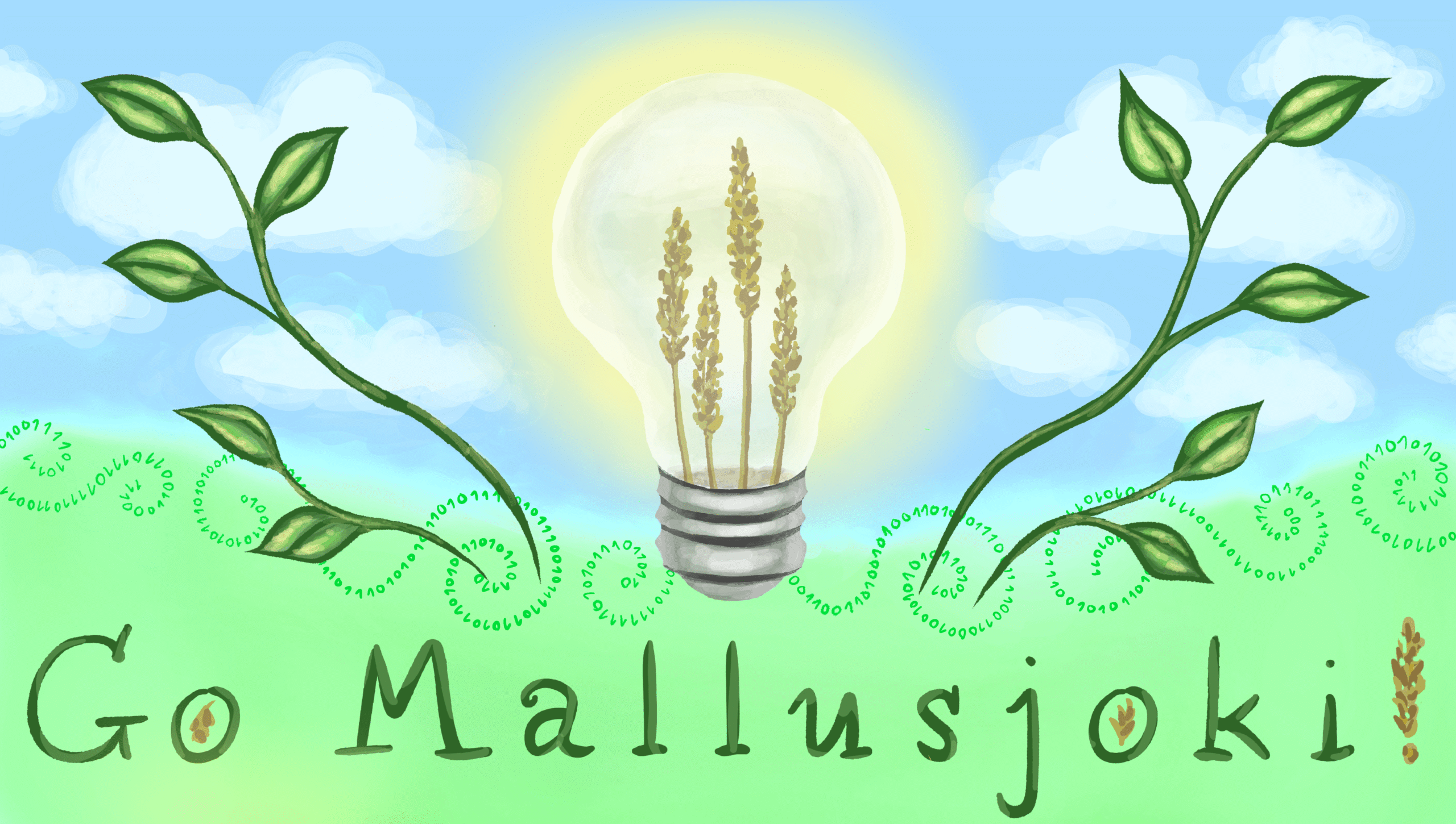
Go Mallusjoki! – Co-Creation for Rural Visibility
Last updated: 23.8.2025 This ideathon strengthens rural-urban interaction through community branding and AI-enhanced creativity. The goal of the project is to co-create a Rural Event Industry Ecosystem branding roadmap, digital visibility concept, and a replicable participatory model. Organised in the Mallusjoki district of Finland, the event brings together locals, students, and experts to co-create a regional branding strategy and envision a Green Culture Centre, using PoliRuralPlus tools to enhance visibility, inclusion, and impact. The best ideas are further analysed with the support of ethical AI tools and developed with local organisations to ensure long-term relevance and implementation. Status Go Mallusjoki!…
Let’s make the planet better together
Are you interested in open-source software development for a better planet for all?
If yes, we just want to say… You weird! Just kidding. We love that! Feel free to shoot us a message below.