Let the Food and Agriculture Organization of the United Nations, the University of Helsinki, and Avoin show you how it´s done.
They say Finland is “the land of thousand lakes”, even though in reality the number is closer to two hundred thousand. Nevertheless, as a Finn, I see the country first and foremost as a land of forests. And no wonder — 75% of Finland is covered in them!
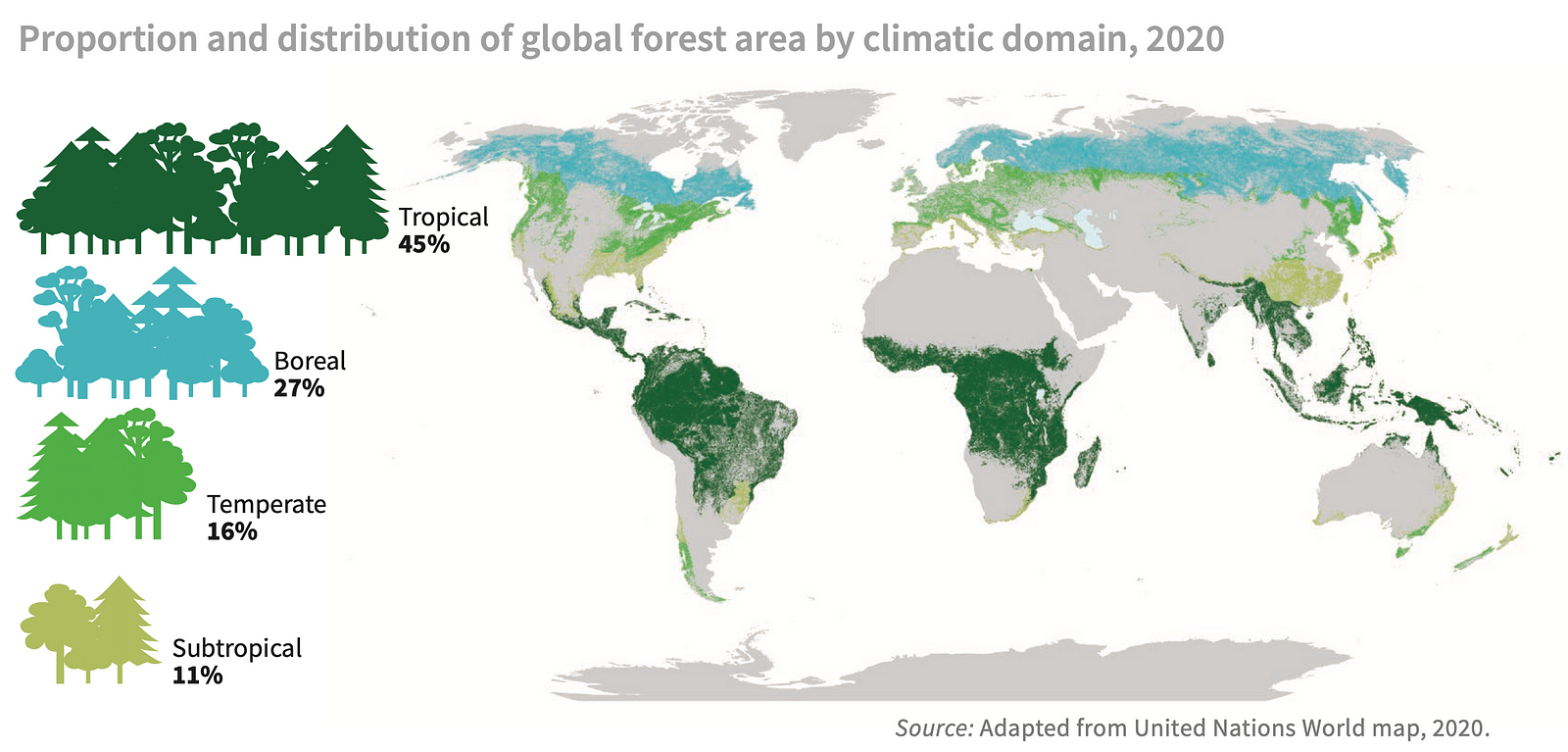
Living in the boreal abundance of Finland, one could easily forget that the earth has lost over 43 million hectares of forest between 2004 and 2017. This is because most of that lost tree cover is tropical and sub-tropical. It is easy not to care about something when it is happening on the other side of the world.
However, deforestation is a huge problem for many reasons which have to do with the survival of Earth´s ecosystems we all rely on.
In this article I am going to discuss The Land Use Change Detection Project (LUCDP), a collaboration between Avoin, the Food and Agriculture Organization of the United Nations (FAO), and data science Master´s students from the University of Helsinki. The goal of LUCDP is to make the global fight against deforestation easier by improving the process of assessing remote sensing data.
Author´s note: this article discusses remote sensing for sustainable development with an emphasis on the fight against deforestation. Read about a different case of remote sensing for sustainable development here.
What is remote sensing and why does it matter?
Remote sensing – including, but not limited to, taking satellite images of the earth´s surface – plays an important role in monitoring changes in our environment, because it gives us a view of the world from a different perspective. For instance, in the field of sustainable development, we can use remote sensing to locate where human activities cause negative environmental effects. This helps us plan well-informed changes that have the potential to alleviate the strain we cause on our planet.
In the case of deforestation, one of the big challenges is to identify areas where land cover changes happen. These changes may be either regrowth or deforestation. Often such changes are caused by human activities like farming and forestry.
Remote sensing plays an important role in monitoring changes in our environment, which in turn helps us alleviate the negative environmental effects of human activities.
The Land Use Change Detection Project
To know more about global land-use changes and their drivers, FAO has developed The Global Remote Sensing Survey as a part of their Global Forest Resources Assessment program. The Survey utilizes satellite images of over 400 000 hexagonal 16-hectare sample sites in the analysis. As a part of the Global Forest Resources Assessment 2020, satellite images were visually assessed by more than 800 participants in 126 countries via a web interface. See a report of the results here.
Visual interpretation of satellite images can get laborious due to the large amount of data. LUCDP was established as a solution to this. Since its beginning in 2019, the project has attempted to develop an automated methodology to recognize areas where changes in land cover take place.
LUCDP was established to make it easier to analyze satellite images for land cover changes.
How does it work?
In LUCDP, satellite images from 7 countries of The Global Remote Sensing Survey are used as training samples. The classification is carried out with the Continuous Change Detection and Classification (CDDC) algorithm. CDDC makes it possible to identify the breakpoints, i.e. points where the land cover class has changed in the years evaluated (2000–2010–2018). The technique helps experts process satellite images faster and with less effort, making the analysis more efficient.
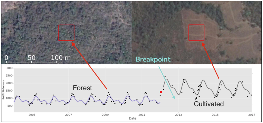
LUCDP utilizes CDDC algorithm to automatically identify satellite images where land cover changes take place, making the analysis more efficient.
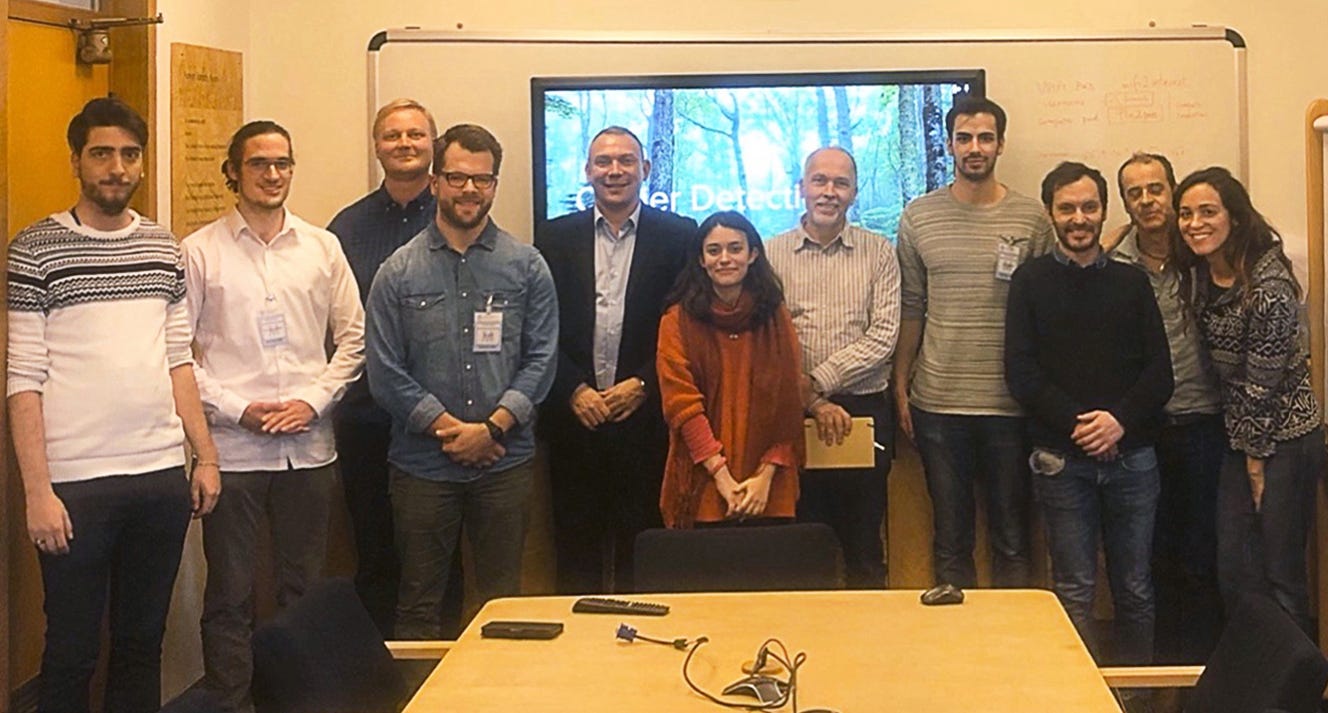
Meeting the team
The expertise in the fields of forestry, remote sensing, and data science is spread across the globe, which is why LUCDP has utilized talent from all around the world. The project brought together both seasoned experts and motivated students. Avoin has facilitated the collaboration from the start, supervising the technical and analytical process.
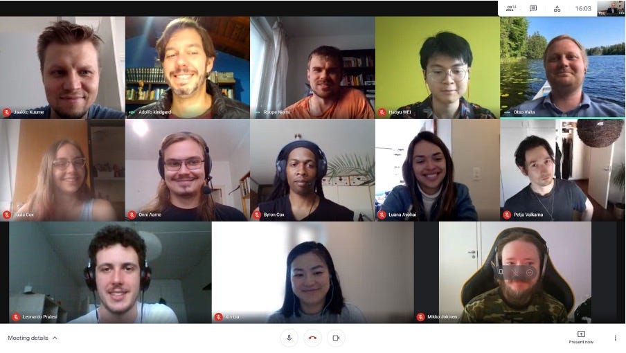
I had the chance to interview some of the participants of LUCDP in the summer of 2021. The way I see it, the project has provided a great learning opportunity for all three organizations, with exciting new prospects opening up in the process.
According to Anssi Pekkarinen from FAO, it was most useful to be able to test existing ideas with the University of Helsinki Master´s students and get fresh input from them. FAO`s Forestry officer Adolfo Kindgard taught the Master´s students how to interpret land use from satellite images, but according to him, learning occurred on both sides. In the future, FAO would like to collaborate with the University of Helsinki on similar data science projects.
For the University of Helsinki Master´s students, the project turned out to be an excellent opportunity to become familiar with remote sensing, as well as FAO as an organization. According to the students, the application of machine learning in LUCDP differed significantly from many other projects at the University of Helsinki, making it a positive challenge. Many of the students found the project especially meaningful because of its common-good orientation.
“Instead of manipulating people´s actions, we want to do something useful”, said one of the computer science master’s students from the University of Helsinki, when asked about their motivation for participating in the project.
For Avoin, the project expanded their experts´ multidisciplinary knowledge. With the help of FAO´s Kindgard, Avoin´s geographic information system analyst Luana Nichele, who has been working with mainly Brazilian forests so far, was able to learn more about different forest types. Avoin is also impressed with the University of Helsinki Master´s students´ work on the project and plans on offering them further development opportunities.
What is next?
Despite LUCDP coming to its end, the collaboration between Avoin and FAO continues. In summer 2021 Avoin and FAO started working on technical improvements and UX design for a geospatial tool, as well as an online game for raising awareness about the world´s forests among young people. This work is done primarily by Avoin’s programmer Petja Valkama, UX designer Lara Jasim, designer Linda Mandell, and programmer Mikko Jokinen, with additional support from several students of the Kajaani University of Applied Sciences.
Thanks to the fruitful collaboration with FAO and the University of Helsinki Avoin will continue developing the algorithm, with the plan of launching an open-source prototype of the land-use change filtering tool in the future. In time, it will become available at: https://github.com/AvoinOrg.
The Land Use Change Detection Project — list of participants
Avoin:
Forest geographic information system expert Luana Nichele — consultation
Senior data scientist Elias Kunnas — technical support and coordination support
Avoin’s chairperson Otso Valta — coordination
Programmer Mikko Jokinen and Chief Technical Officer Petja Valkama — technical support
The Food and Agriculture Organization of the United Nations:
Senior forestry officer Anssi Pekkarinen — consultation, challenge ownership
Forestry officer Adolfo Kindgard — student guidance, implementation of land use-related machine learning models
The University of Helsinki:
Master´s students Dario Hett, Fynn Leitow, and Luca Morganti — participation in 2019
Master´s students Onni Aarne, Jaakko Kuurne, Roope Niemi, Leonardo Pratesi, and Haoyu Wei — participation in 2021
Other parties:
Postdoctoral researcher Xin Liu from The University of Helsinki has been observing the project as a part of her research on data science for sustainable development.
Dr. Andrea Nascetti, a senior earth observation data scientist from KTH Royal Institute of Technology, has acted as a mentor through the Copernicus Accelerator, an arrangement that has been most helpful to both Avoin, FAO, and the University of Helsinki students.
Written by Tuula Cox. This text is the third post in a blog series by Avoin. The blog series discusses environmental protection and sustainable development from the digital point of view.
This blog post was first published via Medium.