Here´s a sneak peek into the development process of the forestry layer of Avoin Map, the virtual mapping tool for sustainable development.
Sustainable forest management is not easy — but digital tools can make it a little easier.
Avoin, a not-for-profit organization focusing on digital tools for sustainable development, has developed its virtual mapping tool Avoin Map since 2018. Avoin Map is designed for people who are interested in data-driven sustainable development. This can mean any people working in the fields that have a high impact on the environment, such as farmers, forest owners, or even city planners. The data on Avoin Map is derived from mainly open-source datasets that are available for public scrutiny, making it also a potential tool for environmental scientists who aspire to adhere to the principles of open science.
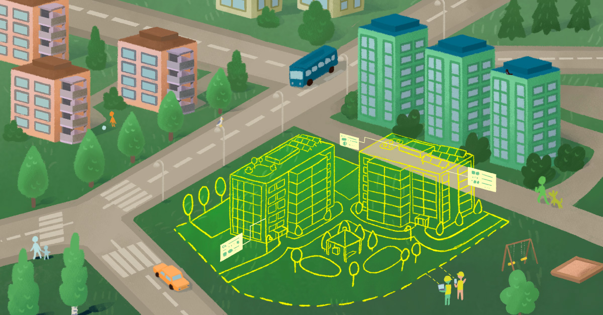
The forestry layer of Avoin Map supports sustainable forest management by visually presenting forest data. This helps forest owners plan actions such as cutting, renewal, and maintenance while keeping track of the economic and environmental impact of those actions.
One of the latest steps in the development of the forestry layer has been updating its data. I talked with software developer Petja Valkama, who is responsible for the technical development of Avoin Map. I also interviewed Aleksi Vihonen from Arvometsä, Avoin´s collaborative partner in the project, and Annukka Valkeapää from Silva Ry. Silva Ry utilizes updated Avoin Map forest data in their environmental impact calculator for forest owners.
What was the process of updating Avoin Map forest data like?
Petja: Avoin Map utilizes forest resource data that is publicly available on the Finnish forest centre website (datasets only available on the Finnish website). Finnish forest centre data covers the entire Finland and is divided by forest stands. It includes information such as average tree height and volume, separately for each tree species. First, I downloaded the raw data from the website. Then, I converted it into a form that can be fed into a program called Metsuri. The conversion took a couple of dozen hours of work.
We collaborate with Arvometsä, a continuous cover forestry company, which uses Metsuri in its forest management services. After I had delivered the raw data to Arvometsä, they ran it in the program. The resulting product was the same dataset, but with calculated estimates of the environmental impact of the forest. In practice, this means estimates such as carbon dioxide equivalent (CO2e) for the soil as well as biomass and wood products, estimates of the nitrogen and phosphorus loads, and biodiversity indicators such as the amount of rotten wood. The estimates are calculated separately for different forestry methods (including continuous cover forestry and clear-cutting).
After I received the refined data from Arvometsä, I merged it with the real estate registry data of the National Land Survey of Finland to make it suitable for Silva Ry´s forest calculator. Finally, I merged it with municipality border data of the National Land Survey of Finland, after which the data was ready to be used in Avoin Map.
Aleksi: Initially Avoin’s team contacted us 4 years ago looking for a collaborative partner for calculations for Avoin Map´s forestry layer data. Usually, we do calculations for individual forest owners, and these calculations cover a wide range of parameters. For Avoin, a narrower take was sufficient. This was the second time we collaborated with Avoin for the forestry layer data update.
The Finnish forest centre data includes thousands of forest stands. Avoin made the dataset lighter, and we used our program Metsuri to make the necessary calculations. Metsuri is developed by Timo Pukkala, a professor emeritus of forest sciences, who is also one of the founding members of Arvometsä. As this was our second time updating the data, we knew what to do. The process itself is always initially tested with a small data sample. When everything has been confirmed to be alright, we perform the calculations for the whole dataset.
Our employee performed the calculations manually for each municipality in Finland. This took 6 weeks. It was surprisingly slow, which I think was because this time around, the calculation was a bit more diverse than last time. This time we did not have to revise any results. The first time was also quite challenge-free.
What is the role of this kind of work in sustainable forestry?
Aleksi: The calculations we did for this data update emphasized the effects that different forestry methods have on the forest´s water emissions. I think that individual forest owners should know about the environmental impact of their forest management choices. It´s important to not just blindly do different things to the forest without knowing how they affect it. I think that is where Avoin Map is useful — it helps the forest owners see how their forestry methods affect the forest and its surroundings.
I started as the CEO of Arvometsä in 2018. I believe that in the coming years, the biggest source of income for an individual forest owner is going to be something else than the wood it produces. I have been trying to steer the company toward the future with this in mind.
Where do you use forestry data?
Annukka: Silva Ry was founded in 2019 to increase awareness of continuous cover forestry. Continuous cover forestry can reduce forest´s water emissions significantly, especially in peatland forests. With funding from Helcom´s Baltic Sea Action Plan, we were able to design a forest calculator to help reduce water emissions in the Baltic Sea. The calculator is easy to use and designed to help forest owners see what kind of emissions their forest is producing.
We planned the project together with Aleksi from Arvometsä, and Mika Nieminen from Luke. The calculator utilizes data from Avoin Map´s forestry layer. Collaborating with Avoin has been very nice — and they have done a fantastic job with the calculator.
Lately, estimations about how much forestry affects the Baltic Sea have been rising, especially regarding peatland forests. We think that in many cases, emission-conscious forestry management can reduce nutrient loads and carbon emissions and still produce good earnings for the forest owner. If a forest owner decides to make a forest management plan utilizing continuous cover forestry, we offer financial support for the plan, provided that the estimated water emission reduction with the method is high enough.
What other digital forestry projects are you working on?
Petja: Another interesting forestry project lately has been estimating biomass on forest stands based on satellite images. In this project, we collaborate with Dr. Andrea Nascetti from the University of Liege and various international partners.
In the project, I trained a machine learning model that can estimate the amount of biomass in any area in Finland only based on satellite images. I had 18 training areas (2kmx2km) and 6 areas that were used to validate the model. This is to prevent the model from learning the data too well so that it becomes biased. Later, this application can power open estimates and map services for clients in and outside of Finland.
For me, it´s important to create digital products that matter. I don´t want to make things for big companies for profit, but solve real problems that mean something to individual people. I love working on these projects for Avoin also because of their versatility. That way, I get to try out a lot of different things, challenge myself and learn.
You can view Avoin Map’s updated Finnish forest data layer here.

Written by Tuula Cox. This text is the eighth post in a blog series by Avoin. The blog series discusses environmental protection and sustainable development from a digital point of view.
This blog post was first published via Medium.